(CNN)A tornado destroyed some residences Friday in Mountainburg, a town in western Arkansas, the National Weather Service in Little Rock and the town's mayor reported.
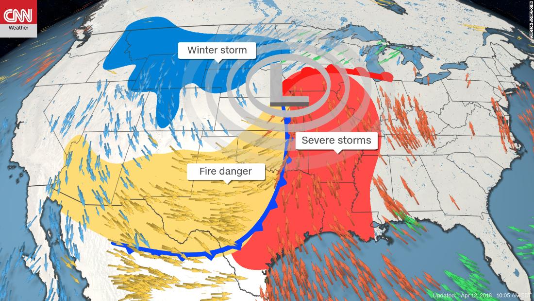
The storm was part of a cocktail of extreme weather taking shape in the United States for the weekend, with severe storms in the Mississippi River valley, critical fire danger in the southern Plains, and heavy snow for the northern Plains and Upper Midwest.
Mountainburg Mayor Neal Moon told CNN several homes and mobile homes were "completely gone" and many others sustained extensive damage. The elementary school was hit by the tornado, Moon said, but children were not there at the time.
Several people were reported trapped in damaged homes, Arkansas Emergency Management spokeswoman Melody Daniel said, citing information from the local emergency manager. Efforts were underway to rescue these citizens, Daniel said.
Crawford County Dispatch said rescue efforts were ongoing but could not speak to any reported injuries.
Moon said he'd heard of heard of only one person who was injured and had to receive stitches.
Emergency response was big, he said, adding the town is "all blue lights."
'Historic' fire danger

As an extensive storm system develops over the intermountain West and pushes east, a significant multiday fire threat is in place from the Southwest into the central and southern high Plains. Thursday marked the second day of the dangerand brought "extremely critical" fire conditions -- the highest threat level -- lasting into Saturday.
The National Weather Service in Norman, Oklahoma, went as far as to say that "historic" fire conditions are expected Friday.
Large blizzard underway
Yes, this weekend marks the middle of April. And yes, heavy snow is still in the forecast for the northern Plains and Upper Midwest.
On the northern side of the storm, frigid air is expected to filter south from Canada. Where the air meets moisture, we will see yet another blast of April snow.
The same strong winds that threaten to turn brush fires into raging infernos on the southwestern side of this storm system will cause blowing snow and whiteout conditions on the northern side.
Read more - https://edition.cnn.com/2018/04/12/us/tornadoes-wildfires-blizzard-wxc/index.html


